Saturday, February 25, 2017
This was the ride our friends mentioned and taking their advice off we went on Saturday. They had never actually taken the ride up but had heard it was a beautiful. They were right the scenery both going up and coming back down is beautiful and the views when you reach the top are fantastic.
 |
| On our way we saw a sign saying Historical Marker so we stopped to read it and take a picture. |
 |
| We turned off of Salome Road onto Eagle Eye Road and 8.5 miles later we found the road that would take us to our destination. |
The road we took up to the Harquahala Peak Smithsonian Solar Observatory is the nationally designated Harquahala Mountain Backcountry Byway.
 |
| After taking the time to read the above information we started up. For the first few miles the road is not to bad. We drove through several washes and there were some rocks. |
 |
| We stopped at a ravine with a wash below to take a couple of pictures. |
 |
| One little brave purple flower all by itself. |
 |
| We saw a lot of saguaros, ocotillos, chollas, and then prickly pears as we got higher. |
After driving up over 3,800 feet in 10.5 miles we reached our destination and parked to enjoy the view. Harquahala Peak is 5681 feet above sea level and the highest mountain in southwestern Arizona. We both took several pictures as we walked around none of which really do justice to the view we saw. One thing for certain after the ride up as we stood there looking out we knew we where on top of a mountain.
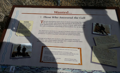
The information boards contain interesting information about the Harquahala Peak Smithsonian Solar Observatory. (The sun was behind us so there was no way to take the pictures without the shadows.)
 |
| We are at the top and have the picture to prove it. |
 |
| If you read the information on the first board It's All A Matter of Communication you will find out what exactly this is and what it does. |
 |
| One last picture |
 |
| and we headed back down. |
On our way up between the rocks and being jostled I spent most of my time hanging on. Honestly, between the blind switch backs, rocks in the road (and we think there were more on the way down), and looking at where we were going I did not think of taking pictures.
 |
| There are a lot of loose rocks to ride over and around. We saw a lot of "fallen rocks" and at times wondered what was keeping some others off the road. |
On the way up as we came around a corner there was a large rock covering half the road. Tom got out to check and could see where others had driven around it. At this point we were fairly close to the summit and had not passed any pullouts for awhile. So, even though we were going to be close to the edge our best choice was to keep going versus backing up. (I took this picture, below, on the way back down and though between the dirty windshield and the glare it is hard to see I am including it.) On the way down looking out my window I could see we were about 4 or 5 inches away from the rock. This was better then my view on the way up when all I could see was air.
 |
| When I mentioned rocks in the road I really meant rocks. |
 |
| This is a stretch of about 100 feet or so of concrete. We wondered how they got it up there and why. |
 |
| The views are spectacular and seem to go on forever. |
 |
| The road is rugged with a few small smooth sections. |
 |
| We are back on flat ground. |
 |
| In a couple of blogs I posted the "Watch out for Cattle" signs, I won't bore you with another one, well today we saw the cattle! |
After we got back to Salome we took a ride over to Joyce and Jerry's 5th wheel and that is when we found out they had never taken the ride up to the peak. Tom and I are glad we took the ride, and we are glad they suggested it. It was a beautiful and the views at the top were well worth it.
I hope you never lose your sense of wonder
You get your fill to eat but always keep that hunger
May you never take one single breath for granted
I hope you still feel small when you stand beside the ocean
I hope you never fear those mountains in the distance
Never settle for the path of least resistance
And when you get the choice to sit it out or dance
I hope you dance
lyrics from "I Hope You Dance" written by Tia Sillers & Mark Sanders


That was a great adventure. Yuma and I will have to take a road trip there since we are not too far away. Thanks for showing us the pictures.
ReplyDeleteWe did enjoy the day. If you and Yuma go stay safe and we will be looking forward to your pictures.
DeleteLooks like you and Doug and Yuma went to the same place. Your blog posts are almost titled identically! :) Beautiful pictures, thank you for sharing!
ReplyDeleteYes, we did. We had seen him on Sunday and told him about the ride we had taken on Saturday up to Harquahala Peak. He talked about going then. I just checked his post...his pictures are so much better. It was a challenging ride so much jostling my wrist hurt from holding on by the time we got to the top.
ReplyDelete