(Clicking on the pictures should open them larger in a new window.)
Sunday, November 29, 2020
We left the Stinger "B" today to take a ride through the Dragoon Mountains. It was a beautiful ride under blue skies and did not disappoint for one minute. The issue would be the amount of pictures I took, well over 200. After going through them three times I did get the number down to just over 100 and made the decision to post them in two blogs. They are all pictures I just could not give up for our memory blog. So fair warning this blog and the next do contain a lot of pictures.
 |
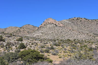
Where we are headed today.
|
The Dragoon Mountains are a range of mountains located in Cochise County, Arizona. The range is about 25 mi (40 km) long, running on an axis extending south-south east through Willcox. The name originates from the 3rd U.S. Cavalry Dragoons who battled the Chiricahua, including Cochise, during the Apache Wars. The Dragoons established posts around 1856 after the Gadsden Purchase made it a U.S. territory. (Information from the Internet)
 |
| Our turn off of AZ-80, Middlemarch Road. |
 |
The pavement ended and so did the shiny clean Jeep
Tom spent time accomplishing a week ago. |
 |
| We are turning right. |
 |
This road was not bad at all.
On our way we passed two pick up trucks with families who
had went this way to cut their Christmas Tree down today. |
 |
No leaves but still standing proud Ocotillo.
|
 |
I stepped out to take the picture above,
and looked back at this view. |
 |
What do you see?
|
 |
Going up
|
 |
and looking out my window.
|
 |
When we got to the top tucked in on our right was
a Class C motor home. Either way he came it must
have been an interesting ride. |
 |
Standing on the edge of this road
|
 |
looking out at the road ahead
|
 |
and the beautiful
|
 |
views in the distance.
|
 |
Taking a look back.
The Class C was just to the left here. |
 |
The Jeep may need another bath.
|
 |
Definitely heading down.
|
 |
I believe this was the best view of the day.
|
 |
We are headed towards Pearce.
|
 |
Not a bad road ahead but it needed more wiggles.
|
 |
Just liked the look of the shadows on the road ahead.
|
 |
| As we reached the valley we passed by a small residential area. |
 |
I asked this donkey if it would mind posing and it looked up.
|
 |
Not wanting to be left out this one headed over.
|
 |
Looking over the Sulphur Springs Valley
|
 |
Just leaving the small residential area we saw this sign.
|
 |
We made a quick stop at Historic Pearce Townsite.
|
The Historic Pearce Township lies in the Sulphur Springs Valley in the geographic center of Cochise County in Arizona. When you stand at the point where Ghost Town Trail and Pearce Road converge, you can turn in any direction and experience the union of the past and the present and the merging of harsh high desert landscaping with the beauty of the surrounding mountains.
Pearce is located between the Cochise Stronghold, Chiricahua National Monument, and the winter Sandhill Crane refuge of Whitewater Draw making it popular for birders, history buffs, hikers, and climbers alike. At 4,400 feet of elevation, the area is also known for its milder summers which make it ideal for quality grapes and vineyards.
Pearce is a mining ghost town named for Cornishman James Pearce, miner and cattleman, who discovered gold nearby at what became the Commonwealth Mine in 1894. The Pearce Post Office was established on March 6, 1896. The railroad station opened in 1903. By 1919, Pearce had a population of 1,500. The town declined in the 1930s and became almost a ghost town in the late 1940s when the mine closed for the last time. (Information found on internet.)
Located in Southeast Arizona .... the heart of the Chiricahua Apache homeland, the people that populated these towns were as diverse as the lands they lived in. The actual "Ghost Town Trail" consists of the towns of Pearce, Courtland and Gleeson. (Information from the Internet) It would be interesting to go back and drive this Trail.
 |
The Ghost Town Trail intersects with
US-191. We were only on the Trail
for a short part of it. |
 |
Turned here to head back towards the Dragoon Mountains.
Our goal to get to a Road numbered 84 and then 795. |
 |
On the map it looked like this road would get us there.
It did not. |
 |
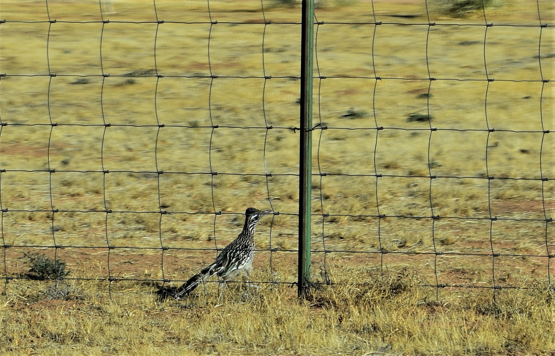
| Back tracking a short ways we passed this guy. |
 |
I was pleasantly surprised he stopped long enough
and with some cropping finally a picture of a roadrunner. |
 |
If you look on the right edge you will see a dog and
at this point that roadrunner was on the move. |
To be continued in the next blog post.
We are so glad you stopped by!
If you have time to leave a comment we would enjoy hearing from you.